Katoomba to Kanangra
A spectacular route through the heart of the southern Blue Mountains wilderness. High camps, rocky ridge tops, steep and rugged terrain and the spectacular Kanangra plateau.
About the K2K walk
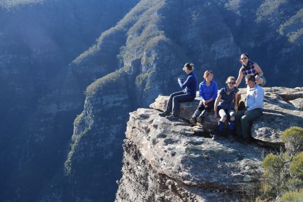
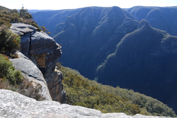
Usually referred to “Kanangra to Katoomba” or K2K, this is a classic walk in the southern Blue Mountains. The walk includes the spectacular Kanangra Walls, the Gangerang Range, the Coxs River valley, the Wild Dog Mountains and the Narrow Neck plateau. These represent some of the iconic and best known landscapes in the southern Blue Mountains.
Although the route can be done by an extremely fit trail runner in 12-15 hours, most bushwalking groups attempt the walk over a somewhat more pedestrian 3 or 4 days. By allowing this amount of time you can enjoy the spectacular scenery, make side trips to points of interest such as Splendour Rock, and enjoy a couple of nights camping away from it all.
The hike incorporates the summit of Mt Cloudmaker, one of the famous Blue Mountains Three Peaks, and most walkers passing over this summit would sign the logbook there.
The total distance of the walk is 52km, with a total of 3044m of ascent and 2991m of descent over the 4 days!
The area was severely burnt in the 2019-2020 bushfires and since then has become densely overgrown with faint or non-existent tracks and dense vegetation that is difficult to push through. Therefore the hike we do will be done over 4 days.
I have had more than 40 years experience of bushwalking along this route and I look forward to welcoming you on this trip. My trips allow you the autonomy of bringing your own gear and food, whilst providing you full guiding services, navigation, knowledge of the route and area, and organisation of all the logistics. Join a group of like minded people to hike this iconic route with the reassurance of it being led by an experienced guide.
Being a point to point walk, one of the logistical challenges is arranging transport to or from Kanangra Walls. Kanangra Walls is at the terminus of the Kanangra Walls road, about 1 hour and 40 minutes’ drive from Katoomba. There is no public transport to or from Kanangra Walls so private transport needs to be arranged for pickup from or dropoff at Kanangra Walls. This can be arranged by private car or minibus depending on the number of people attending.
Although the walk can be done in either direction, I run the trip in the direction of Katoomba to Kanangra, because this is by far the best direction to do the hike in, in terms of logistics and the grand finale of the spectacular Kanangra Plateau!
Day By Day Itinerary
The guided hike is done over 4 days, with the first and last days being quite long, and the middle two days being relatively short.
Normally clients will arrive in Katoomba the day before the hike and arrange their own accommodation in Katoomba.

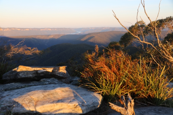
The first day is the longest in distance of the entire walk. Early in the morning (around 6:30am) you will be picked up from your accommodation in Katoomba and driven to the start of the Narrow Neck plateau from where the walk will commence. We walk out along the Narrow Neck plateau along a fire trail, a distance of 10km. At the end of the plateau you descend Tarros Ladders, a series of metal spikes down the cliff face! Care needed! From here we descend on a well trodden walking trail to Medlow Gap, and thence continue around the Wild Dog Mountains staying on the well trodden trail until we reach Mobbs Swamp. Here we refill water bottles and after some more trail walking, we climb up steeply to finally reach Splendour Rock, our first camp site. Splendour Rock is a truly spectacular place, a prominent rock outcrop from where panoramic views of the southern Blue Mountains can be beheld. We camp among the trees a little way back from the exposed rock itself.
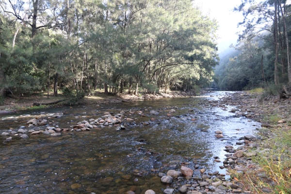
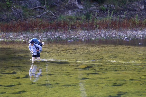
Enjoy the sunrise from Splendour Rock. After breakfast we continue the walk. Descend from Splendour Rock and continue along the Wild Dog Mountains walking track to reach Mt Yellow Dog. The track is very overgrown in places. From here it is a long descent to the Coxs River. Take a welcome break here, it is the one and only river encountered on the route. A short walk upstream is our campsite in a lovely peaceful sandy river bank. Take the afternoon off and have a swim in the river, and for those interested, learn some navigation skills similar to those taught on my navigation training weekends.
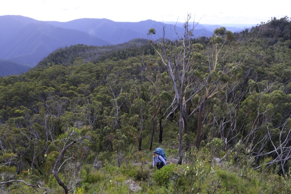
Today is a day of sustained climbing. Directly across from our campsite is the base of the long spur up Mt Strongleg. This long hard climb brings you to Mt Strongleg, from where it is still quite a long walk on a stony and densely overgrown path to reach the Gangerang Plateau and some beautiful views. You now walk through sub-alpine scrub, heath and forest to finally reach Dex Creek, the high headwaters of a small creek fed by a pristine hanging swamp. This is where we will make our final camp.
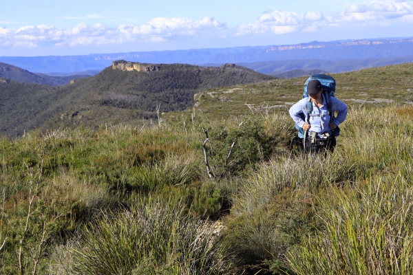
From Dex Creek it is about 45 minutes' walk on a gently rising trail to reach the summit of Mt Cloudmaker, one of the Blue Mountains Three Peaks with its cairn and logbook. After signing the logbook we follow the Gangerang Range, a very mountainous trail with lots of ups and downs over several peaks including Mt Stormbreaker, Mt High And Mighty and Mt Berry. We traverse around the base of Crafts Wall on a difficult trail. At last we reach the Kilpatrick Causway and climb up steeply onto Kanangra Walls. This last hour of walking along Kanangra Walls is one of the most spectacular and beautiful sections of hiking trail anywhere in Australia and must be savoured as a privilege to remember. The end of the walk isn't far away, and as soon as we leave the majestic Kanangra Walls, we arrive at the Kanangra Walls Car Park and your waiting transport. We then drive back to Katoomba via the Hampton Half Way House, a well known watering hole. The trip concludes upon reaching Katoomba, whereupon you can travel home by your own arrangements or spend another night in Katoomba.
Elevation Profile

What You Need to Bring
Being a self-supported bushwalk, the idea is that everyone brings their own gear and food for the weekend. Click the button below to review the gear list for this trip.
If you don’t have some of the items listed, don’t worry, many of the items can be borrowed or rented for a small fee.
Level of Difficulty

Still Unsure?
Don’t hesitate to write to me if you are unsure if the trip is suitable for you.
Key Difficulties
The key difficulties of the K2K hike are the dense regrowth following the 2019-2020 bushfires, the distance to be covered each day, and the large amount of elevation gain.
Overgrown Route
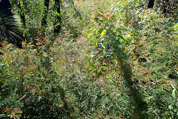
The entire area was badly burnt in the 2019-2020 bushfires and in the wet seasons since, has become badly overgrown. A rough trail has been pushed through most of the way but there are still sections, particularly on Day 3, which are badly overgrown, and pushing through this dense scrub while climbing steeply is very arduous.
Long Distance on Days 1 and 4
The total distance of the walk is 52km, with 3044m of ascent and 2991m of descent over the course of the 4 days.
Both the first day and the last day are rather long (20km and 13km respectively) with lots of ups and downs. The middle two days are both shorter and these two days can be combined into one longer day if desired.
Lots of Ups and Downs
There is substantial loss and gain of elevation on the walk which means there are long descents and ascents. The highest point on the walk is Mt Cloudmaker at 1155m, and the lowest point is the Coxs River at just 150m. That is a 1000m range in elevation, and there are countless ups and downs during the course of the 4 days to add more to the amount of climbing and descending that you need to do! Expect long knee crushing descents and seemingly endless quad screaming climbs, especially on Day 3!
Rough Terrain and Faint Path
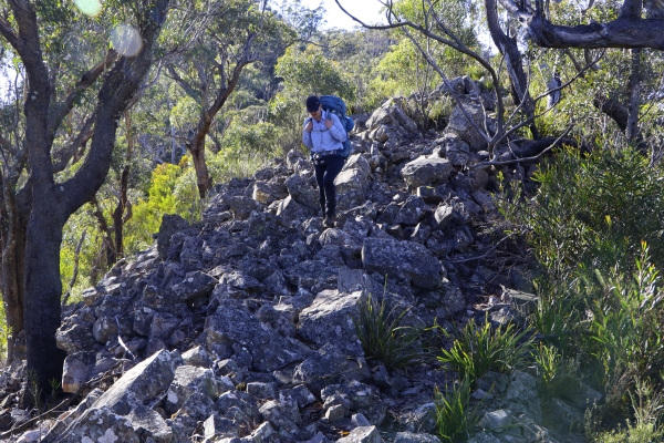
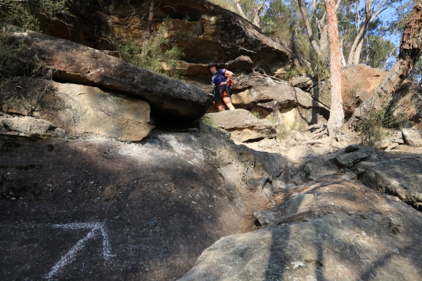
The track is often rough, stony and hard to follow with many dips, turns and obstacles. On the last day the knolls past Mt Cloudmaker (Rip, Rack, Roar and Rumble) are steep and stony and care must be taken on the trail there. Also on the last day the traverse around the base of Crafts Wall is rough, slow and hard on the ankles. This makes the last day a long and difficult day despite the distance being only 13.2km.
Tarros Ladders
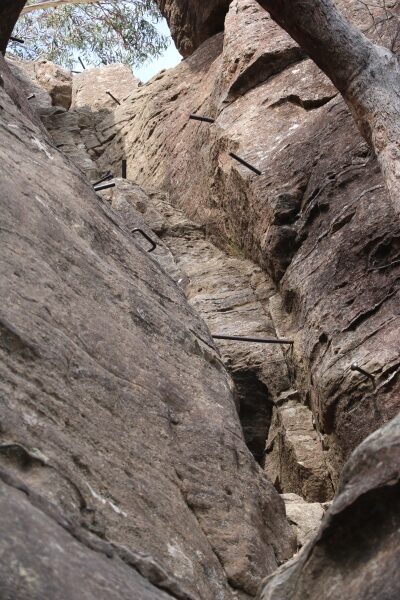
Another challenge of this walk is the descent of Tarros Ladders, which is a cliff face with metal spikes in them which you use as handholds and footholds to descend. It is exposed and a top rope will be provided for security while you descend these spikes.
The Reward for all This
The reward for all this effort is to transect a vast swathe of the southern Blue Mountains wilderness, taking in majestic mountain scenery in the process. It is strongly recommended that all participants undertake some form of fitness training for at least the 2 months prior to the trip. Ideal fitness preparation would be similar activities to what we’ll actually be doing on this walk, namely bushwalking with a backpack and climbing up and down long hills. If it is not practicable for you to do training bushwalks prior to this trip then any form of long walk with as much hill climbing and descending as you can practicably manage would place you in good stead for this trip.
Price for Katoomba to Kanangra Hike
The size of the group is capped at 4 clients.

